


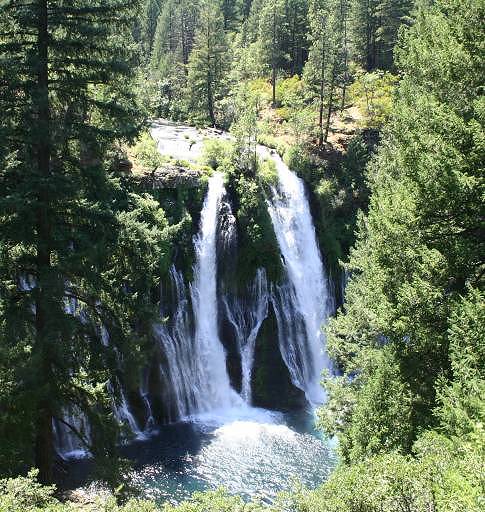
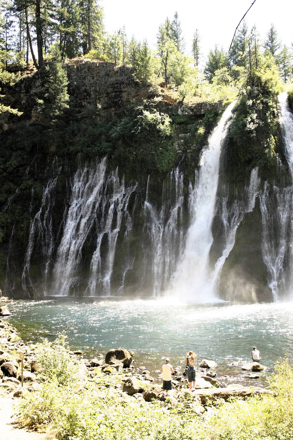
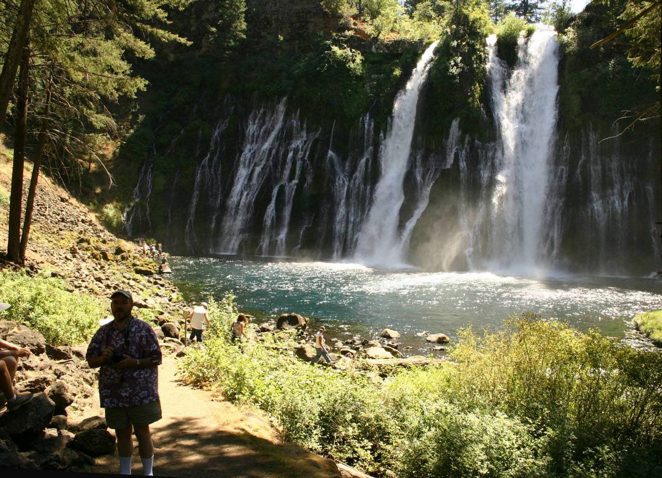
From Mammoth to Klamath today, passing through Reno in a little dip into Nevada. The best part of the day’s trip was a little detour to Burney, in Shasta County, and the McArthur-Burney Falls Memorial State Park. This is definitely worth a detour. The water pours down not only from the stream above, as you see in the top picture, but also out from the porous volcanic rock of the cliff, at every level.
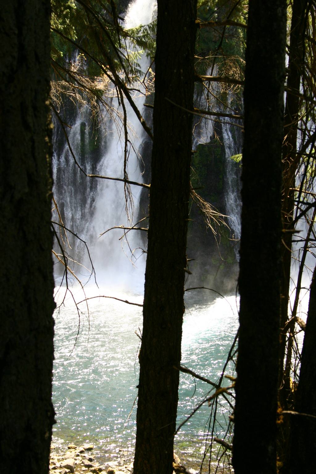
 Here’s another view from the level of the upper stream.
(Big image; small.)
Here’s another view from the level of the upper stream.
(Big image; small.)
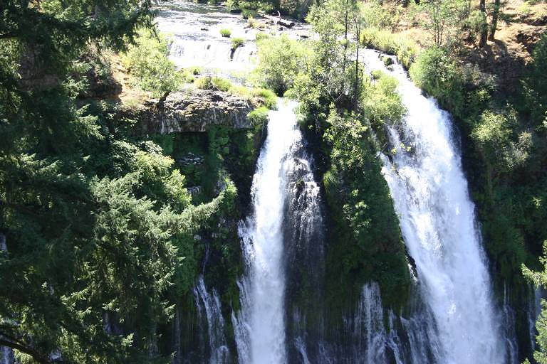
 A nice walk of a few minutes’ length brought us to the lower level,
where not only was it pleasantly cool, but the view was much more interesting
than from above. (Left thumbnail: big image;
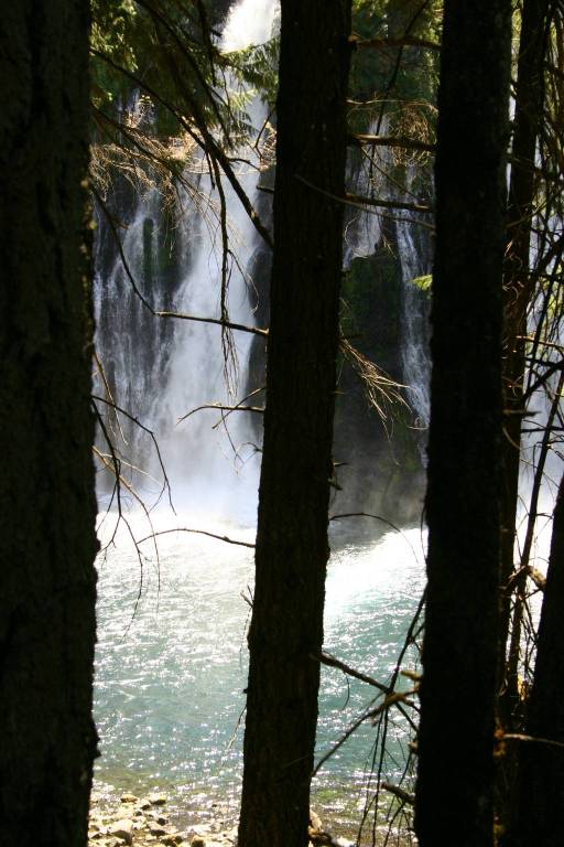
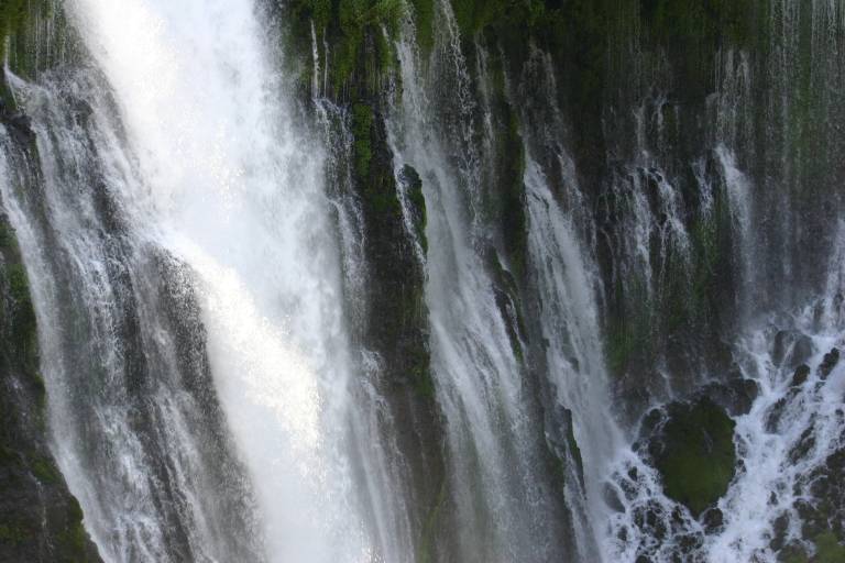
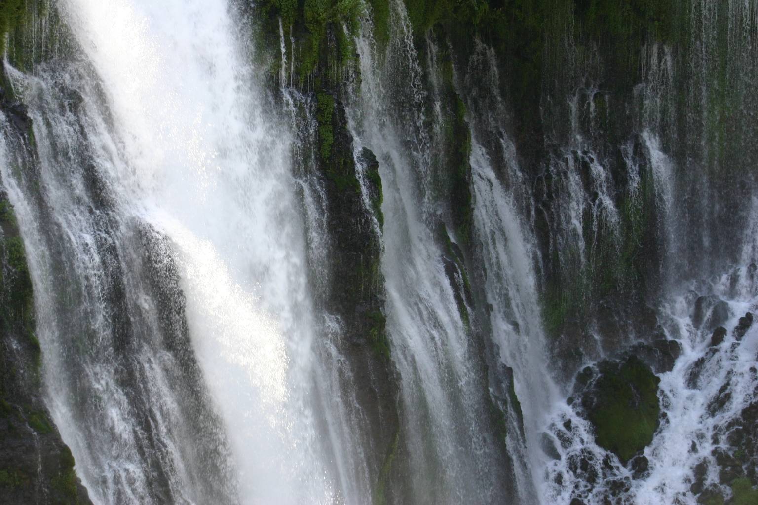
small.) In the close-up, you can
see how the water pours out from all levels (middle thumbnail:
big image, small).
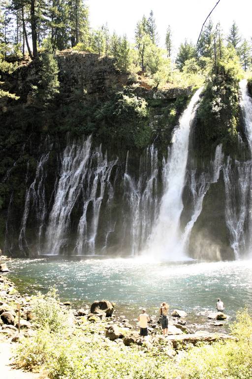
The wide view (right thumbnail) gives some idea of the size of the falls.
(Left thumbnail: big image;
small.)
A nice walk of a few minutes’ length brought us to the lower level,
where not only was it pleasantly cool, but the view was much more interesting
than from above. (Left thumbnail: big image;
small.) In the close-up, you can
see how the water pours out from all levels (middle thumbnail:
big image, small).
The wide view (right thumbnail) gives some idea of the size of the falls.
(Left thumbnail: big image;
small.)
 Before long, we were ready to get into the car and go the rest of the way to
Klamath Falls (where we saw no falling water).
(Big image; small.)
Before long, we were ready to get into the car and go the rest of the way to
Klamath Falls (where we saw no falling water).
(Big image; small.)
This day’s drive had been very long, and we were eager to get to our room. Unfortunately, however, our motel had no place for us, because of a confusion between them and Travelocity, which Mark had used for making all the reservations. They did have a place reserved for us at another, perfectly adequate, place, which we hotfooted it to. “Perfectly adequate” almost describes the evening meal we had there in KF: it was at an Applebee’s, so I think I need say no more. On my birthday! But we made up for it the next night, in Walla Walla, a town that surprised us in more ways than one.
Previous day’s pictures; next day’s pictures
Return to the main Northwest Trip page; to my home page.